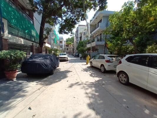
At the far northern edge of Delhi, close enough to Sonipat that the Haryana border feels like a formality, Lampur sits within Narela tehsil as one of the region’s older Saini-founded settlements. Established centuries ago by the Saini community, who historically held zamindari and jagirdari rights over the land, Lampur retains a genuinely rural character even as it functions as one of Narela sub-division’s officially recognised revenue villages.
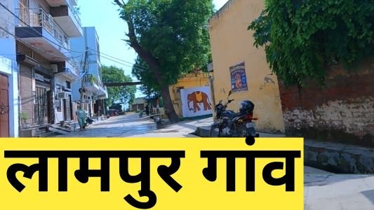
Lampur Village Overview
| Detail | Information |
| Location | North West Delhi, near Narela |
| District | North West Delhi |
| Tehsil | Narela |
| PIN Code | 110040 |
| Post Office | Narela |
| Assembly Constituency | Narela |
| Distance from Narela | Approx. 3–4 km |
| Distance from IGI Airport | Approx. 36–38 km |
| Known For | Saini community heritage, agricultural land, Narela proximity |
| Nearby Localities | Narela, Ghoga, Bhorgarh, Bawana, Holambi Kalan |
A Saini-Founded Village in Narela’s Revenue Belt
Lampur was established centuries ago by the Saini community, who traditionally held zamindari (landowning) status in the village, with the presence of a Saini Jagirdar reflecting the settlement’s historical significance within the local agricultural economy. Today, Lampur is officially listed among the recognised revenue villages of Narela sub-division, alongside neighbours like Bakhtawar Pur, Alipur, Bhor Garh, and Holambi Kalan.
- The village majority population and land ownership remains dominated by the Saini community, giving Lampur a distinct social character within North West Delhi’s outer villages.
- Its position 10 km north of the North West Delhi district headquarters at Kanjhawala places it firmly within Delhi’s northern rural fringe, close to both Sonipat and Bahadurgarh in Haryana.
- Lampur sits at the border of North West Delhi and North Delhi districts, giving the village a location that touches multiple administrative boundaries within the capital.
Getting To and Around Lampur Village
Lampur benefits from genuinely convenient rail access via Narela Railway Station, alongside multiple DTC bus routes serving the village directly.
By Rail
- Narela Railway Station sits just 561 metres from Lampur Village, roughly an 8-minute walk, making it one of the more rail-accessible villages in this stretch of North West Delhi.
- Trains run through the day, with the first service around 5:47 AM and the last around 9:57 PM, giving residents a reliable daily commuting window.
By Bus
- Multiple DTC and DIMTS bus routes, including 131A2, 131STL2, 175, and 175STL, stop directly at Lampur Village, with the nearest bus stop just a minute’s walk away.
- Bus services run from as early as 4:44 AM to nearly midnight, offering residents flexible transport options throughout the day.
By Road
- Local roads connect Lampur to nearby villages including Ghoga, Bhorgarh, Bawana, and Holambi Kalan, with onward routes toward Narela town and further into North West Delhi.
What’s Nearby: Markets, Schools, and Neighbouring Villages
Lampur’s own commercial and civic infrastructure remains modest, typical of villages in Narela sub-division, so residents commonly rely on nearby Narela town for broader shopping, healthcare, and educational needs.
Local Markets
- Small shops within Lampur cover daily grocery and household essentials for the local population.
- Narela’s more established commercial area, just 3–4 km away, offers a considerably wider range of retail, banking, and market facilities, including the historic Narela Mandi agricultural market.
Healthcare and Education
- Basic healthcare facilities typical of Narela sub-division’s villages serve routine medical needs within Lampur, with more comprehensive hospital access available in Narela town.
- Residents generally rely on schools within the broader Narela catchment for both basic and higher education.
Neighbouring Villages
- Ghoga, Bhorgarh, Bawana, and Holambi Kalan are among the villages closest to Lampur, all part of the same Narela sub-division revenue village network.
Why Lampur Remains a Distinct North Delhi Village
Lampur’s continued relevance rests on its deep-rooted Saini community heritage combined with genuinely practical rail and bus connectivity that many comparably remote Delhi villages lack.
- Its proximity to Narela Railway Station, just an 8-minute walk away, gives residents a level of daily commuting convenience uncommon among Delhi’s outer northern villages.
- The village’s historical zamindari roots and Saini community identity continue to shape its social character, distinguishing it from more recently urbanised parts of Delhi.
- Its border position between North West Delhi, North Delhi, and Haryana’s Sonipat district keeps Lampur relevant for residents with practical ties across these administrative lines.
Frequently Asked Questions
Q1. How far is Lampur Village from Narela Railway Station?
Very close — just 561 metres, roughly an 8-minute walk from the village.
Q2. What is the PIN code for Lampur Village?
The PIN code is 110040, with Narela serving as the postal head office.
Q3. Which community historically founded Lampur village?
The Saini community established Lampur centuries ago, and it remains the dominant population and landowning group in the village today.
Q4. Is Lampur well-connected by public bus?
Yes, multiple DTC and DIMTS routes including 131A2, 131STL2, 175, and 175STL stop directly at Lampur Village, with services running from early morning to late night.