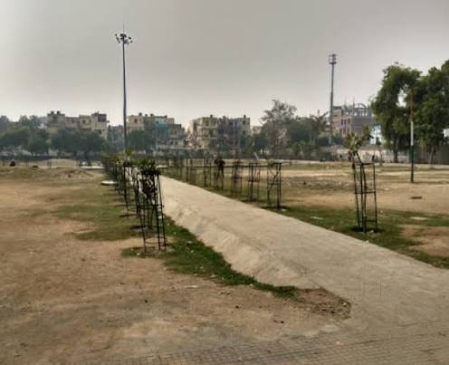
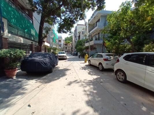
North West Delhi’s industrial map has few names as prominent as Bawana, home to one of Asia’s larger planned industrial estates and a resettlement colony that grew out of some of Delhi’s biggest slum relocation drives in the 2000s. What began as a rural village on the capital’s outer edge is now a working-class hub of factories, warehouses, and dense residential blocks, distinct in character from the more commercial or heritage-driven localities found elsewhere in Delhi.
Bawana Village Quick Overview
| Detail | Information |
| Location | North West Delhi |
| District | North West Delhi |
| Nearest Metro Station | Bawana (Red Line) |
| Distance from Rohini | Approx. 8–10 km |
| Distance from Connaught Place | Approx. 30–32 km |
| Distance from Narela | Approx. 6–8 km |
| Known For | Bawana Industrial Area, JJ resettlement colonies |
| Notable Landmark | Bawana Industrial Estate (DSIIDC) |
| Nearby Localities | Narela, Rohini, Alipur, Mundka |
| Best For | Factory workers, small business owners, budget tenants |
An Industrial Village on Delhi’s Northern Fringe
Bawana sits well beyond the Ridge and Delhi’s central belt, in the northwestern stretch of the capital that shares more infrastructure similarity with Narela and Alipur than with the city’s older commercial zones. Its transformation from farmland into an industrial hub was largely engineered — the DSIIDC-developed Bawana Industrial Area was purpose-built to relocate polluting units out of central and south Delhi in the early 2000s.
- The Bawana Industrial Area is one of Delhi’s largest planned industrial estates, housing thousands of small and medium manufacturing units relocated from other parts of the city.
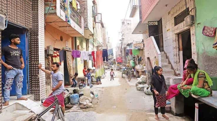
- Large sections of Bawana were developed as JJ (Jhuggi Jhopri) resettlement colonies, giving the locality a dense, working-class residential character built around factory employment.
- The area’s northern position keeps it somewhat isolated from Delhi’s central commercial corridors, making local employment and self-contained infrastructure especially important to residents.
Reaching Bawana: Metro, Road, and Bus Options
Bawana’s transport network has improved considerably since the Red Line metro extension reached the area, though much of daily commuting within the locality still depends on road-based transport given its sprawling, factory-heavy layout.
By Metro
- The Red Line’s Bawana station gives residents a direct rail link toward Rithala, Rohini, and onward into central and old Delhi, cutting what used to be a long, congested road commute.
- Feeder autos and e-rickshaws connect the station to the surrounding industrial estate and residential colonies, which are spread across a fairly large area.
By Road
- The Outer Ring Road and roads connecting toward Narela and Rohini serve as the main arteries linking Bawana to the rest of Delhi.
- Heavy vehicle traffic is common given the industrial nature of the area, with trucks and loading vehicles a regular presence on approach roads during working hours.
- Internal roads within the industrial estate are laid out in a grid, making navigation between factory blocks relatively straightforward once inside.
By Bus
- DTC buses running through Narela and Rohini routes pass through Bawana, remaining one of the most affordable options for daily workers commuting from other parts of North West Delhi.
Everyday Needs Around Bawana
Given its scale, Bawana has developed a reasonably self-sufficient local economy for daily essentials, though residents still travel to Rohini or Narela for more specialised shopping and services.
Local Markets
- Bawana’s own market areas cater primarily to the working population, offering groceries, basic clothing, and household goods at prices generally lower than in central Delhi.
- Rohini’s more established commercial sectors, a short drive away, provide a broader range of retail and branded stores for those seeking more variety.
Healthcare Facilities
- Government dispensaries and private clinics within Bawana handle routine medical needs, while larger hospitals in Rohini are within a 20–25 minute drive for advanced treatment.
Schools and Education
- A number of government and private schools operate within the resettlement colonies, serving the area’s large residential population, with families often relying on Rohini for higher-rated senior secondary options.
Why Bawana’s Industrial Identity Defines the Area
Bawana’s development has been almost entirely shaped by planned industrial relocation, and that origin story continues to influence property costs, employment patterns, and daily life here.
- Employment opportunities are heavily concentrated in manufacturing, making it a practical base for factory and warehouse workers rather than office commuters.
- Rental and property costs remain considerably lower than in Rohini or other established North West Delhi localities, largely a function of the area’s industrial and resettlement origins.
- The Red Line metro connection has meaningfully improved access to central Delhi, reducing dependence on the area’s traditionally congested road network.
Frequently Asked Questions
Q1. Does Bawana have metro connectivity?
Yes, the Red Line’s Bawana station connects the area directly to Rithala, Rohini, and central Delhi.
Q2. What kind of jobs are common in Bawana?
Mostly manufacturing and factory work, given its location within the large DSIIDC-developed industrial estate.
Q3. Is Bawana a good option for affordable housing in Delhi?
Yes, rental and property costs here are noticeably lower than in nearby Rohini, largely due to its industrial and resettlement colony origins.
Q4. How congested are Bawana’s roads during working hours?
Fairly congested, particularly near the industrial estate, due to heavy vehicle and truck traffic linked to the area’s manufacturing base.